Planning a remodel or land purchase in Aptos Hills or Corralitos? One detail can change your timeline and budget: whether your parcel sits in California’s Coastal Zone. If it does, permits and possible appeals can add steps you should plan for. In this guide, you’ll learn how to confirm your parcel’s status in minutes using official county tools, plus what it usually means for permits and project timing. Let’s dive in.
Coastal Zone basics
The Coastal Zone is a state-defined area where California’s Coastal Act applies and local governments implement it through a Local Coastal Program. In Santa Cruz County, the boundary is irregular and varies by location, so you need a parcel-level check rather than guessing by distance from the shore. County guidance explains what the zone is and why it matters for permitting through the Coastal Development Permit process. You can review that overview in the county’s Coastal Development Permits page and FAQ for context.
- Learn how the county defines the Coastal Zone and when permits apply on the county’s Coastal Development Permits page: County CDP guidance.
- See the Coastal Commission’s statewide mapping and background: Coastal Commission LCP/CZ maps.
How to check your parcel
Follow this sequence, starting with county tools. These are the most direct sources for parcel-specific answers.
1) Gather your APN
Find your Assessor’s Parcel Number on your tax bill or through the county Assessor’s site. You can also search by street address.
- Look up your APN: Santa Cruz County Assessor.
2) Use the county GIS map
Open the county’s GIS mapping app, search by APN or address, then turn on the Coastal Zone layer. Also toggle the separate Coastal Zone Appeal Jurisdiction layer. If your parcel is shaded within these layers, note it and save a screenshot.
- Step-by-step map instructions: Is My Property in the Coastal Zone?.
3) Run the county parcel report
Generate the free Parcel or Property Report. It summarizes zoning, hazards, and whether county mapping shows the parcel inside the Coastal Zone.
- Get reports here: County parcel and records research.
4) Cross-check with the Coastal Commission
If you want the state’s view or are considering a project that might be appealed, compare your parcel with the Commission’s Coastal Zone and Local Coastal Program map viewer. Digital boundaries are for planning and may not serve as a legal survey, so use this as a cross-check.
- Statewide map viewer: Coastal Commission LCP/CZ maps.
5) Ask for a determination when needed
If the line looks close or you need certainty, contact County Planning with your APN. Staff can confirm whether the parcel is inside the Coastal Zone and whether any appeal jurisdiction applies. For complex projects, you can request a formal determination.
- County Planning contacts: Planning counter and appointments.
What Coastal Zone status means
If your parcel is in the Coastal Zone, many projects require a Coastal Development Permit from the county or, in limited cases, the Coastal Commission. “Development” is broad and can include new construction, major remodels, grading, land divisions, and changes in use or density. Some small projects may be exempt, but exemptions are limited and fact specific.
- County overview of CDP triggers and exemptions: Coastal Development Permits.
Appeal jurisdiction basics
Even when the county approves a CDP, some approvals can be appealed to the Coastal Commission. This usually relates to location or project type, for example projects between the sea and the nearest through public road, within certain distances of the beach, bluffs, streams, or wetlands, or proposals for uses not normally permitted. The county GIS shows a separate Appeal Jurisdiction layer to help you identify this early.
- Appeal rules and examples: County FAQ on coastal appeals.
Exemptions and common traps
There are limited exemptions, such as some improvements to existing dwellings or certain replacements after disaster, when conditions are met. Properties developed without prior coastal permits often cannot rely on these exemptions for first-time permitting. Always confirm exemptions with County Planning before you proceed.
- Read about exemptions and limits: County CDP guidance.
Hazards and sea-level rise review
Coastal Zone parcels may need additional studies for geologic hazards, erosion, bluff stability, flood risk, or sea-level rise. Local and state guidance continues to evolve, and these factors can affect permit scope and conditions.
- Planning and permitting guidance for sea-level rise: Coastal Commission SLR guidance.
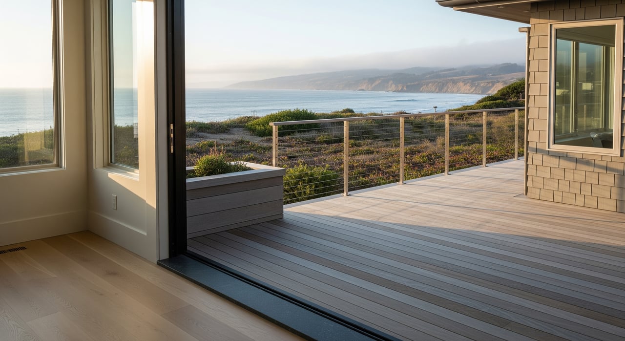
Aptos Hills and Corralitos tips
In Santa Cruz County, the Coastal Zone boundary varies by area. West-side Aptos locations and neighborhoods nearer the coast, such as Seacliff and Rio Del Mar, often fall within the mapped Coastal Zone. Corralitos sits farther inland, but parts of the broader area near the west side or coastal creeks can still be inside the zone. The takeaway is simple: do not assume by community name. Always check at the parcel level using the county’s GIS and report tools.
- County overview and mapping links: Coastal Development Permits.
Timing and transaction impacts
CDP review can add time and cost to a project. If your parcel is within the Appeal Jurisdiction, an approved permit can be appealed to the Coastal Commission, which adds a separate process and can add months. Buyers and sellers often disclose Coastal Zone status because it affects development potential and permitting timelines.
- Learn what to expect: County CDP process overview.
Quick checklist
- Find your APN on the Assessor’s site or tax bill, then open the county GIS and turn on the Coastal Zone and Appeal Jurisdiction layers, and save a screenshot for your records. (Assessor lookup)
- Run the county Parcel or Property Report to confirm zoning, hazards, and Coastal Zone status. (Parcel research)
- If your parcel falls inside the Coastal Zone or Appeal Jurisdiction, contact County Planning to confirm whether a CDP or other reviews apply, and to verify any exemptions. (Planning contacts)
- For complex projects or uncertainty near the boundary, request a formal determination or consult a coastal specialist. Appeals change timing and risk. (Commission appeals overview)
Ready to review a specific parcel in Aptos Hills or Corralitos, or to plan a permit-aware strategy for your sale or purchase? Connect with The DeBernardo Team for discreet, senior-level guidance tailored to Santa Cruz County’s coastal market.
FAQs
How far inland does the Coastal Zone reach in Santa Cruz County?
- It varies by area, so you should confirm at the parcel level using county tools and the Coastal Commission map viewer rather than relying on distance estimates. (County CDP guidance)
Is a Corralitos address usually outside the Coastal Zone?
- Not always, since parts of the broader area near the west side or coastal creeks can fall inside the zone, which is why a parcel-level check is essential. (County mapping how-to)
What is the Coastal Zone Appeal Jurisdiction for Aptos properties?
- It is a mapped area where certain county CDP approvals can be appealed to the Coastal Commission, often due to proximity to the beach, bluffs, or streams. (County appeal FAQ)
Do small home improvements in Aptos Hills need a CDP?
- Some improvements may be exempt, but exemptions are limited and depend on the facts, so you should confirm with County Planning before starting work. (County CDP guidance)
How long can a Coastal Development Permit add to a project?
- Timelines vary, but you should plan for added review time, and if an approval is appealed to the Coastal Commission it can add months. (County CDP overview)
Are the online Coastal Zone maps legally binding for my parcel?
- They are planning tools that guide permitting, and for legal certainty you can request a formal determination from County Planning. (Coastal Commission map viewer and Planning contacts)